-
Help Support TNDeer:
You are using an out of date browser. It may not display this or other websites correctly.
You should upgrade or use an alternative browser.
You should upgrade or use an alternative browser.
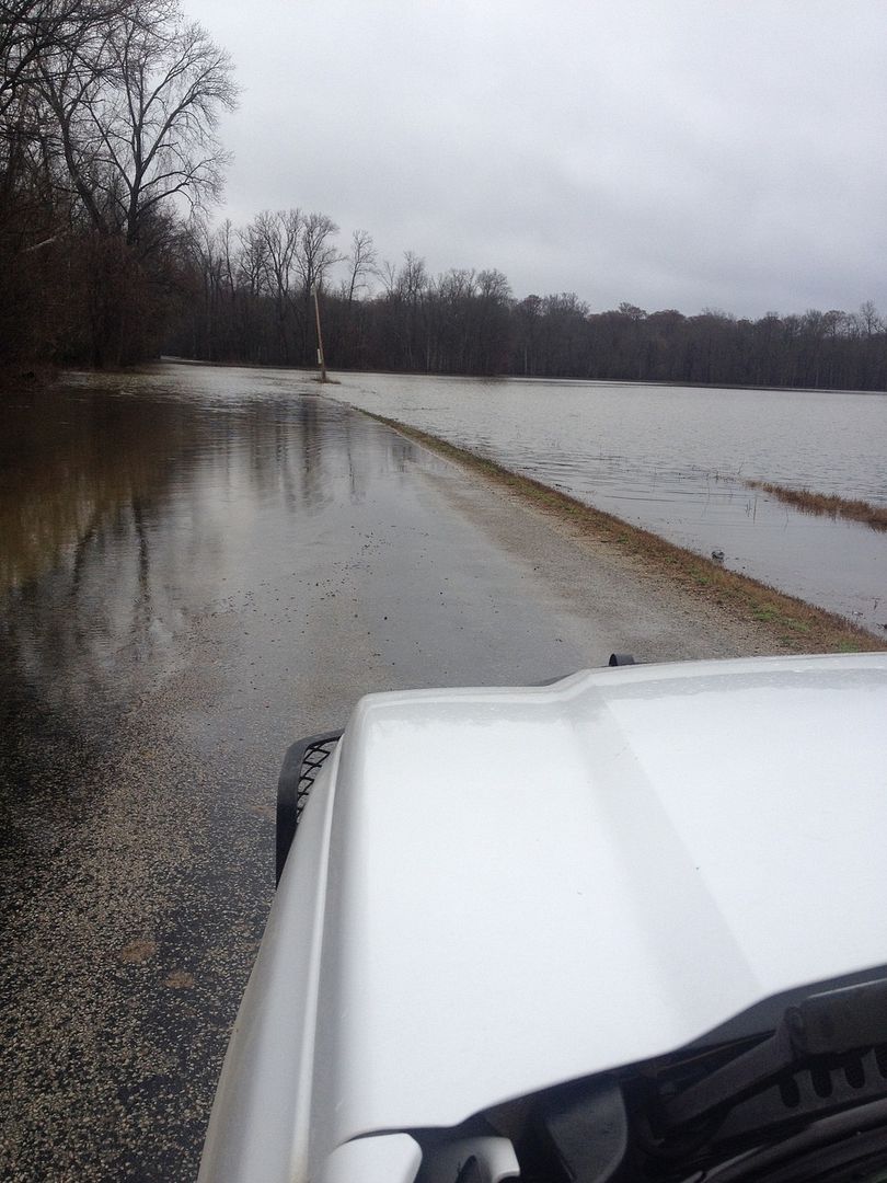
Chickasaw NWR FLOODED!
- Thread starter Thicketmaster
- Start date
easy45
Well-Known Member
I got drawn for there one time and it looked the same way when I went for my hunt
That is to be expected with the current river stages. Good update for those who were drawn and thanks for the picture, it puts things in perspective for those not familiar with the bottom.
The pic looks like it was taken on Barr Road, shortly after you make the S curve and head due north, basically southeast side of refuge.
Thicketmaster
Well-Known Member
That's where it was you can't even get to refuge property line it's under water!Andy S.":2nd2n6sa said:The pic looks like it was taken on Barr Road, shortly after you make the S curve and head due north, basically southeast side of refuge.
callemquacktn
Well-Known Member
This flooding happened about 3.5 months too late.
Southern Sportsman
Well-Known Member
Aint that the truthcallemquacktn":1yz5spwe said:This flooding happened about 3.5 months too late.
TN Whitetail Freak
Well-Known Member
County line rd at Trimble TN
Hunt 365
Well-Known Member
WOW. Going to crest tomorrow from what I read. Good thing is, will recede fast, and have hunted a recently flooded, but drained field this time of year and turkeys were everywhere eating earthworms and snails. Provided you can walk through the mud to get there!
Not if a person knows where to go, by boat. Maybe it will fall in time.
Obion River backwater, correct? I realize the big river is pushing all the tributaries backward, which is causing a lot of crop land to be inundated. I have watched the Wolf River back water continue to rise over the last week on my drive to work.TN Whitetail Freak":3fw5vks0 said:County line rd at Trimble TN
Mike Belt
Well-Known Member
I've tried to hunt up there when it's been like this before. If you know where high ground is you may find birds but most of that is on private land. Otherwise, the birds never leave the trees. I've seen them have to spend almost the entire season in the treetops. I always carried me a few throw lines or yoyos so it wouldn't be a complete wasted trip.
eddie c
Well-Known Member
tickweed":292g92tn said:Not if a person knows where to go, by boat. Maybe it will fall in time.
that was my thought too. we had some buddies that only hunted the place by boat 20 years ago.
Yes Eddie, I was one. I will be glad to help you. Did you draw by chance? There are several stretchs of the road that are dry. We killed many birds wearing waders. One ridge was unbelieveable on high water. I think every bird in the bottom knows where the high spots are.eddie c":1u78eig2 said:tickweed":1u78eig2 said:Not if a person knows where to go, by boat. Maybe it will fall in time.
that was my thought too. we had some buddies that only hunted the place by boat 20 years ago.

